Locus C.8L72.015
Installation · Plaster installation or surface
General Information
Interpretation
Installation Description
Type
Certain:
Surface
Probable:
Possible 1:
Work area
Possible 2:
Material
Limestone Qualifier 1:
Limestone Qualifier 2:
Limestone Percent:
Bedrock Qualifier 1:
Bedrock Qualifier 2:
Bedrock Percent:
0
Ceramic Qualifier 1:
Ceramic Qualifier 2:
Ceramic Percent:
0
Mud Qualifier 1:
Mud Qualifier 2:
Mud Percent:
Mudbrick Qualifier 1:
Mudbrick Qualifier 2:
Mudbrick Percent:
Nari Qualifier 1:
Nari Qualifier 2:
Nari Percent:
0
Plaster Qualifier 1:
Plaster Qualifier 2:
Plaster Percent:
0
Earth Qualifier 1:
Earth Qualifier 2:
Earth Percent:
0
Stone Qualifier 1:
Stone Qualifier 2:
Stone Percent:
60
Plan
Type:
Rectangular
Quality 1:
Slightly
Quality 2:
Remarks:
Lining
Lining:
Stone
Measurements
Greatest Length in meters:
1
Greatest width in meters:
0.6
Smallest width in meters:
0.5
Greatest Height in meters:
0.29
Lowest Height in meters:
0.19
Orientation (degrees):
20
Remarks
Remarks:
When first uncovered, this installation appeared to be a compact earth surface, like Surfs 6, 10, & 16; it was only a remnant of a surface, as all edges seem to be broken off; the poss existed that it was connected to Surf 16 (which runs along the E balk) at the installation's N-most point, however, the connection was not clear; Surf 16's S-most point also could have been a later resurfacing of Surf 16; Installation 15 is at a higher level than any of the surrounding loci; in the N half of the installation is a cup-like depression whose surface is continuous with the rest of the installation surface; it is 10 cm deep & 30 cm in diameter; it may have been a small storage cup, or used for holding or preparing some liquid or food; when the installation was sectioned, it became clear that it was made of plaster & stones: beneath 1 cm of the compact earth surface was a layer of crushed limestone plaster with a sandy texture which cannot be broken down into lumps; beneath & throughout the plaster are smaller & then (deeper down) larger limestone cobbles (5-10 cm); these in turn are set into the hard compact material of L 22; a cross-section through the installation would have a concave shape; the section clearly showed that the installation is a part of Surf 16, the separation being a vertical line; the surfaces are coplaner
Supplements
Additional descriptions recorded later as the locus was further excavated.
Supplement 1
Supplement 2
Levels
| Location | Top Level | Bottom Level |
|---|---|---|
| 29 | 892.98 | 892.69 |
| 29 | 892.88 | 892.69 |
| 34 | 893.04 | 892.8 |
Stratigraphy
| Relationship | Related to | Related locus |
|---|---|---|
| Under | Earth layer | C8L72:004 |
| Cuts | Earth layer | C8L72:022 |
| Cuts | Earth layer | C8L72:013 |
| Cut by | Earth layer | C8L72:017 |
| Seals against | Surface | C8L72:016 |
| Seals against | Wall | C8L72:008 |
Pails
| Number | Date | Baskets | Total | Diagnostic | Published |
|---|---|---|---|---|---|
| 37 | 23 July, 1984 | 2 | 30 | 0 | 0 |
| 42 | 24 July, 1984 | 13 | 26 | 2 | 0 |
| 43 | 24 July, 1984 | 7 | 61 | 2 | 0 |
Photos
| Date | Photo Number | Subject | Photo |
|---|---|---|---|
| 23 July, 1984 | 84C72363 | Progress |
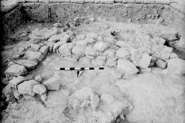
|
| 24 July, 1984 | 84C72388 | Progress |
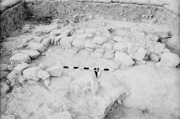
|
| 24 July, 1984 | 84C72390 | Installation 15 & Surf 16 |

|
| 24 July, 1984 | 84C72390 | Installation 15 & Surf 16 |
|