Locus H.7K02.046
General Information
Locus Type:
Architecture
Supervisor:
C. Tyson
Designation:
E-W Wall
Reason:
Stones in a line
Top Separation:
Very Clear
Bottom Separation:
Start Date:
13 Jul, 2016
End Date:
13 Jul, 2016
Interpretation
Function:
Stratigraphy remarks:
Balk:
Phase:
Stratum :
Architecture Description
Material
chert Qualifier 1:
chert Qualifier 2:
chert Qualifier 3:
chert Percent:
Limestone Qualifier 1:
Limestone Qualifier 2:
Limesotne Qualifier 3:
true
Limestone Percent:
100
basalt Qualifier 1:
basalt Qualifier 2:
basalt Qualifier 3:
basalt Percent:
nari Qualifier 1:
true
nari Qualifier 2:
nari Qualifier 3:
nari Percent:
mudbrick Qualifier 1:
mudbrick Qualifier 2:
mudbrick Qualifier 3:
mudbrick Percent:
Arch Frags:
Fragment Type:
Quarry:
Wall Stones
Cobble (6-25 cm) %:
5
Small Boulder (25-50cm) %:
55
Medium Boulder (50-75cm) %:
45
Large Boulder (75-100cm) %:
Very Large Boulder (>1 m) %:
Chinkstones
Pebble (.2-6 cm) %:
15
Cobble (6-25 cm) %:
85
Fillstones: (in Rubble-filled Construction)
Cobble (6-25 cm) %:
Small Boulder (25-50cm) %:
Medium Boulder (50-75cm) %:
Large Boulder (75-100cm) %:
Very Large Boulder (>1 m) %:
Brick
Length (upper):
Length (lower):
Width (upper):
Width (lower):
Depth (upper):
Depth (lower):
Dressing: (Stone Only)
Unhewn %:
100
Semi-hewn %:
Dressed %:
Ashlar %:
Bossed %:
Tooling (Stone Only)
Upper Width:
Lower Width:
Upper Length:
Lower Length:
Sketch:
Photo:
Mortar
Dry-laid %:
100
Clay %:
Mud %:
Cement %:
Plaster %:
Average Thickness:
Facing
Facing:
Unfaced
Color:
Construction
Style:
Boulder & Chink
Support:
Tendencies:
Courses
Highest Count:
3
Lowest Count:
3
Random:
Rows
Highest Count:
Lowest Count:
Two with Rubble:
Random:
Measurements
Greatest Length in meters:
2.1
Greatest width in meters:
0
Smallest width in meters:
Greatest Height in meters:
1.21
Lowest Height in meters:
1.06
Orientation (degrees):
285
Dip (degrees):
0
Preservation
Preservation:
Partial Superstructure: Half
Lean Direction (degrees):
Lean Degrees:
Top Foundation Level:
Remarks
Remarks:
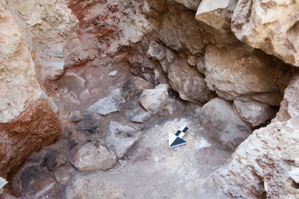
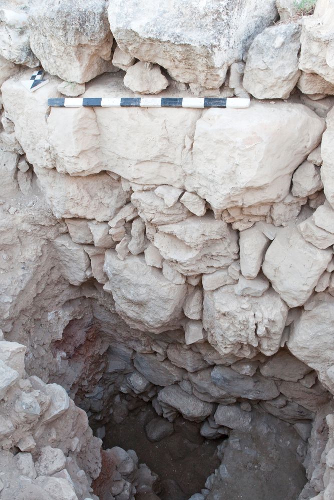
The GPS point for the top of the wall (16H02027) was taken approx. 40 cm to the N of the wall at about the right height. This was necessary because the top of Wall 46 is offset by approx. 20 cm from the bottom of Wall 2.
Levels
| Location | Top Level | Bottom Level |
|---|---|---|
| 0 | 911.82 | 910.78 |
Stratigraphy
| Under | Wall | 002 |
| Sealed agnst by | Earth layer | 043 |
| Sealed agnst by | Earth layer | 045 |
| Abutted by | Wall | 047 |
| Over | Wall | 055 |
| Sealed agnst by | Surface | 052 |
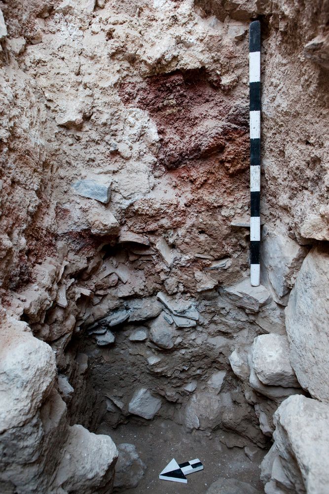
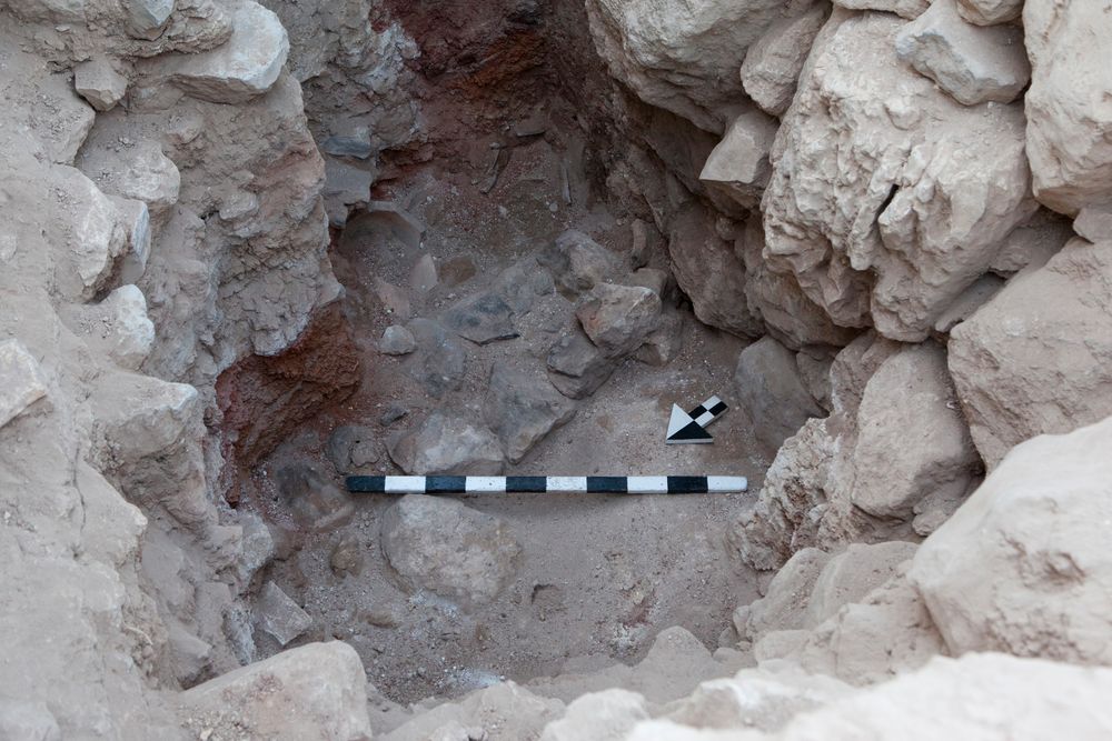
Photos
| Date | Photo Number | Subject | Photo |
|---|---|---|---|
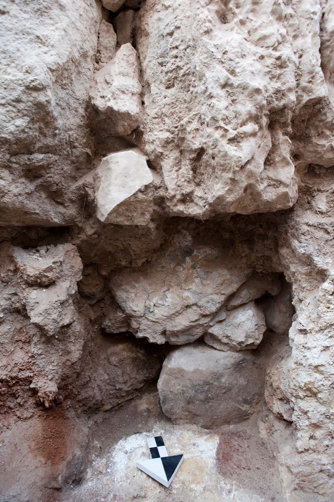
| 27 Jul, 2016 | 16H02261 | FINAL |
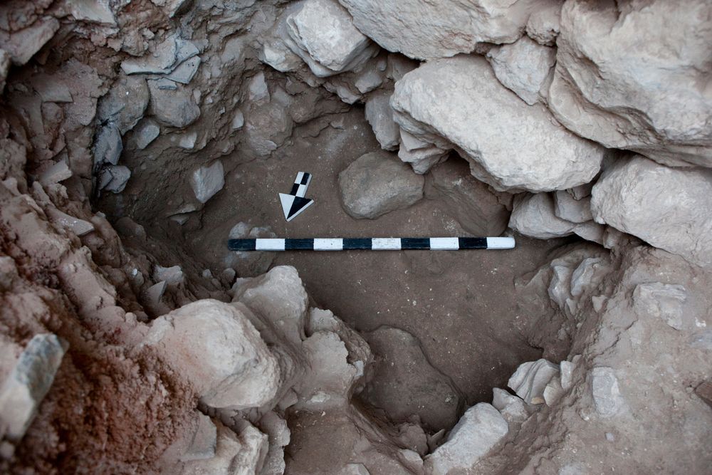
|
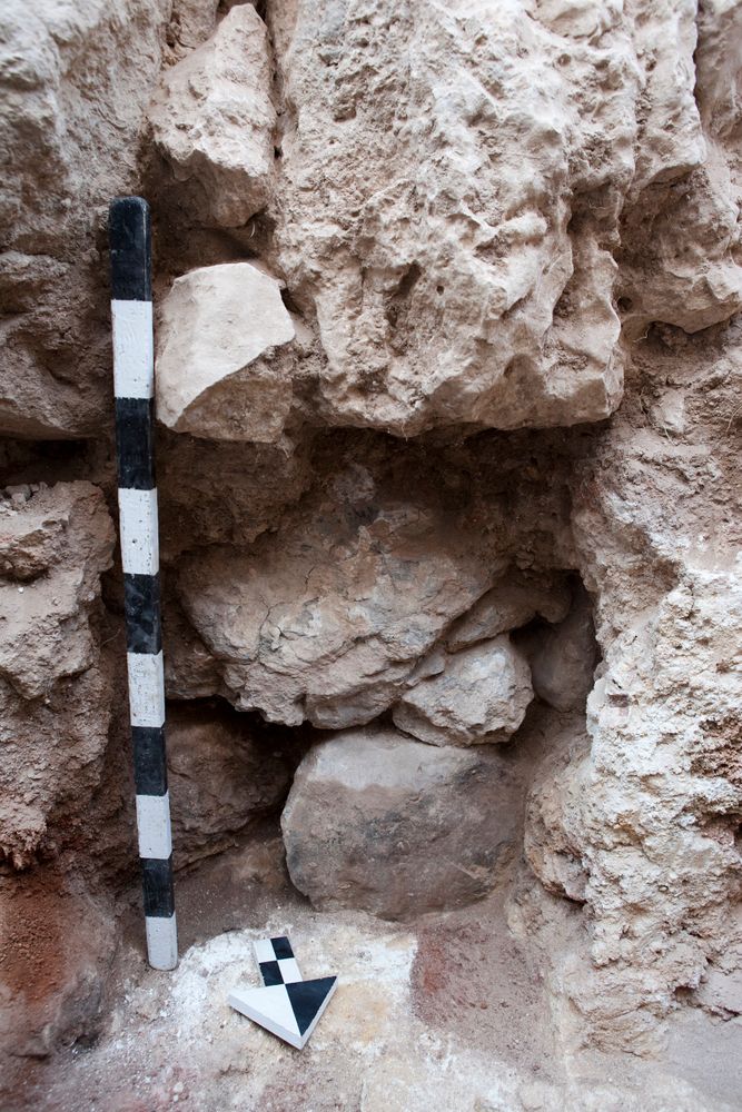
| 27 Jul, 2016 | 16H02263 | FINAL |
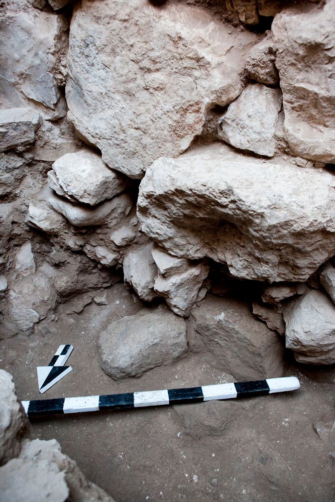
|
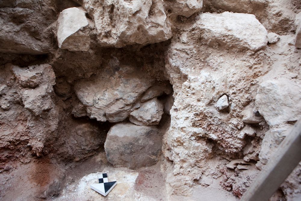
| 27 Jul, 2016 | 16H02264 | FINAL |
|
| 15 Jul, 2016 | 16H02158 | PROGRESS |
|
| 14 Jul, 2016 | 16H02149 | BEGINNING OF 46 |
|
| 14 Jul, 2016 | 16H02150 | BEGINNING OF 46 |
|
| 14 Jul, 2016 | 16H02151 | BEGINNING OF 46 |
|
| 14 Jul, 2016 | 16H02153 | BEGINNING OF 47-49 |
|
| 14 Jul, 2016 | 16H02154 | BEGINNING OF 47-49 |
|
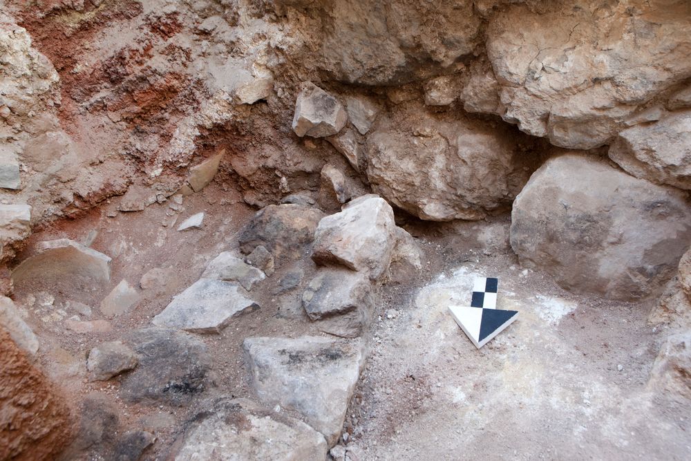
| 27 Jul, 2016 | 16H02267 | FINAL |
|