Locus E.0002.041
General Information
Locus Type:
Architecture
Supervisor:
L. Herr
Designation:
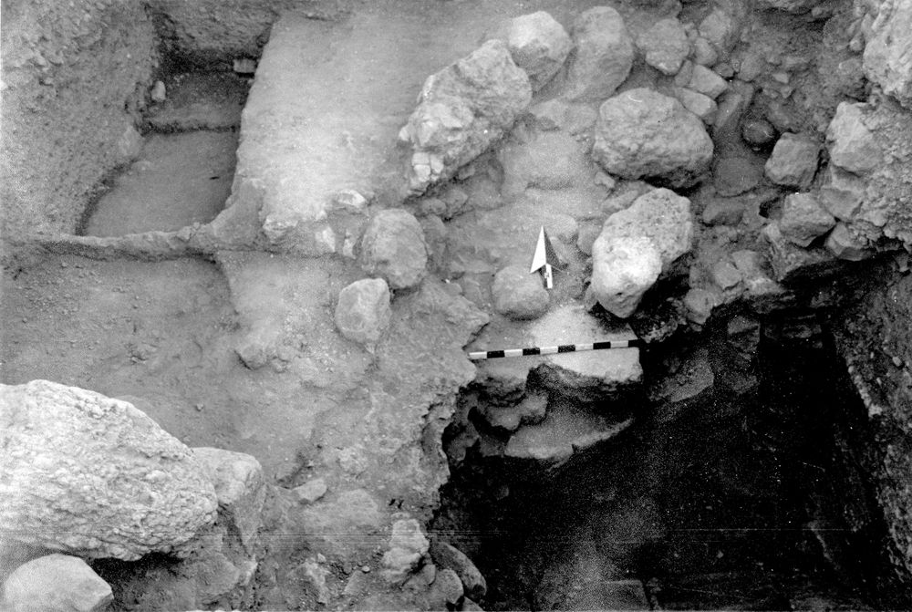
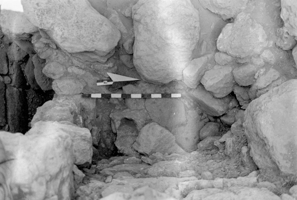
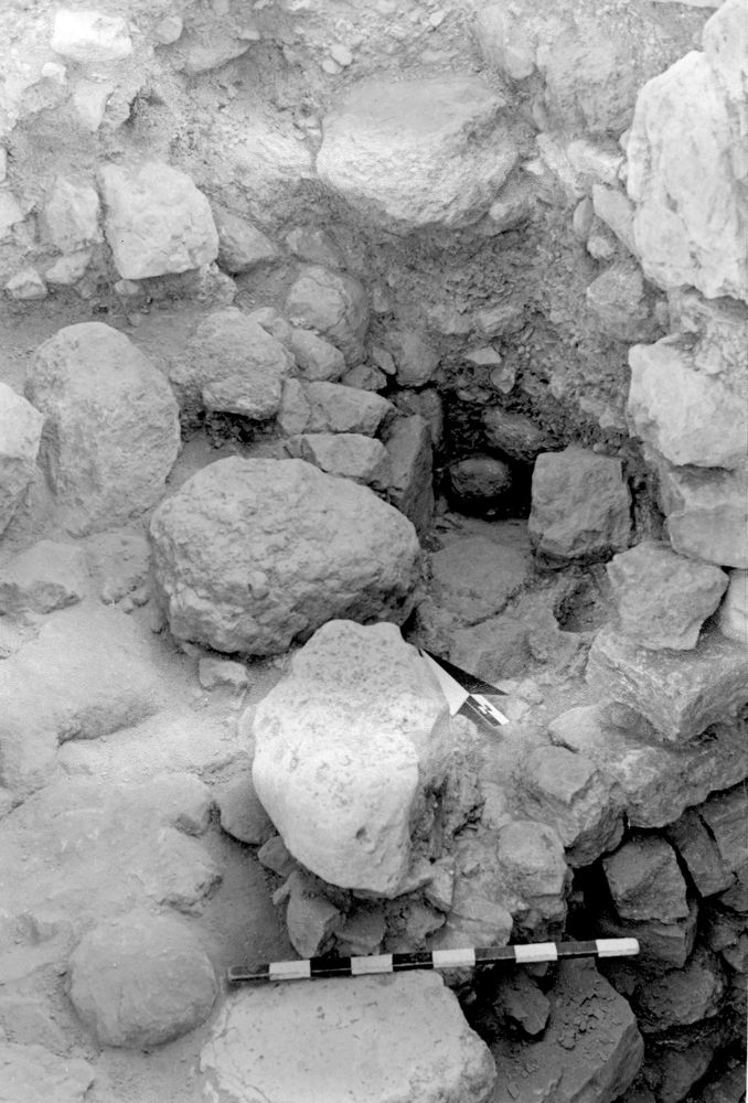
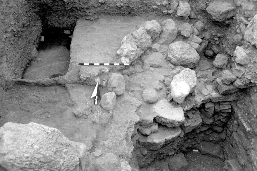
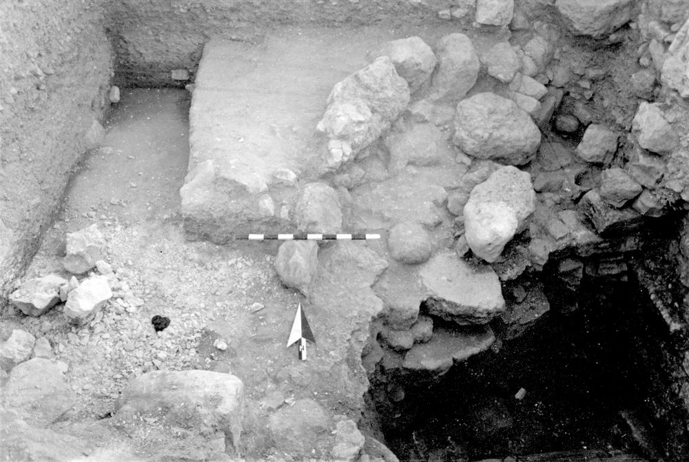
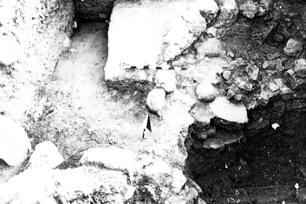
Side walls of water channel/Plastered water channel.
Reason:
Reached plaster at bottom of channel
Top Separation:
Very Clear
Bottom Separation:
Very Clear
Start Date:
12 Jul, 1989
End Date:
04 Aug, 1989
Interpretation
Function:
Water channel to take water away from well (slope was to N)
Stratigraphy remarks:
Balk:
Phase:
Stratum :
Architecture Description
Material
chert Qualifier 1:
chert Qualifier 2:
chert Qualifier 3:
chert Percent:
0
Limestone Qualifier 1:
Hard
Limestone Qualifier 2:
Limesotne Qualifier 3:
Limestone Percent:
100
basalt Qualifier 1:
basalt Qualifier 2:
basalt Qualifier 3:
basalt Percent:
0
nari Qualifier 1:
nari Qualifier 2:
nari Qualifier 3:
nari Percent:
0
mudbrick Qualifier 1:
mudbrick Qualifier 2:
mudbrick Qualifier 3:
mudbrick Percent:
Arch Frags:
0
Fragment Type:
Quarry:
Wall Stones
Cobble (6-25 cm) %:
0
Small Boulder (25-50cm) %:
Medium Boulder (50-75cm) %:
0
Large Boulder (75-100cm) %:
0
Very Large Boulder (>1 m) %:
0
Chinkstones
Pebble (.2-6 cm) %:
0
Cobble (6-25 cm) %:
100
Fillstones: (in Rubble-filled Construction)
Cobble (6-25 cm) %:
0
Small Boulder (25-50cm) %:
0
Medium Boulder (50-75cm) %:
0
Large Boulder (75-100cm) %:
0
Very Large Boulder (>1 m) %:
0
Brick
Length (upper):
0.0
Length (lower):
0.0
Width (upper):
0.0
Width (lower):
0.0
Depth (upper):
0.0
Depth (lower):
0.0
Dressing: (Stone Only)
Unhewn %:
0
Semi-hewn %:
Dressed %:
0
Ashlar %:
0
Bossed %:
0
Tooling (Stone Only)
Upper Width:
0.0
Lower Width:
0.0
Upper Length:
0.0
Lower Length:
0.0
Sketch:
false
Photo:
false
Mortar
Dry-laid %:
100
Clay %:
0
Mud %:
0
Cement %:
0
Plaster %:
0
Average Thickness:
0.0
Facing
Facing:
Unfaced
Color:
Construction
Style:
Boulder & Chink
Support:
Battered
Tendencies:
Courses
Highest Count:
0
Lowest Count:
1
Random:
false
Rows
Highest Count:
0
Lowest Count:
2
Two with Rubble:
Random:
false
Measurements
Greatest Length in meters:
2
Greatest width in meters:
0
Smallest width in meters:
0.55
Greatest Height in meters:
0
Lowest Height in meters:
0.23
Orientation (degrees):
0
Dip (degrees):
0
Preservation
Preservation:
Foundation Only: Partial
Lean Direction (degrees):
0
Lean Degrees:
0
Top Foundation Level:
0.0
Remarks
Remarks:
Levels are for top of stone wall at sides of channel; slope was away from the well
Levels
| Location | Top Level | Bottom Level |
|---|---|---|
| 11 | 866.74 | 0 |
| 17 | 866.76 | 0 |
Stratigraphy
| Under | Earth layer | E0002:039 |
| Cuts | Earth layer | E0002:040 |
| Cuts | Wall | E0002:035 |
Pails
| Number | Date | Baskets | Total | Diagnostic | Published | ||||||||||||
|---|---|---|---|---|---|---|---|---|---|---|---|---|---|---|---|---|---|
| 93 | 31 Jul, 1989 | 0 | 7 | 7 | 0 | ||||||||||||
Pottery Readings
|
|||||||||||||||||
Photos
| Date | Photo Number | Subject | Photo |
|---|---|---|---|
| 17 Jul, 1989 | 89E02401 | Progress |
|
| 13 Jul, 1989 | 89E02398 | Water Channel |
|
| 13 Jul, 1989 | 89E02399 | Water channel |
|
| 18 Jul, 1989 | 89E02402 | Progress |
|
| 19 Jul, 1989 | 89E02403 | Progress |
|
| 20 Jul, 1989 | 89E02404 | Progress |
|