Locus D.5K87.017
Earth · Beaten-earth exterior exposure surface
General Information
Interpretation
Earth Description
Color
Munsell Number:
10YR 5/4
Texture
Texture:
Sand clay loam-Silty clay loam
Particle Shape A %:
0
Particle Shape AS %:
0
Particle Shape SR %:
0
Particle Shape R %:
0
Consistence
Hardness:
Loose
Compactness Description 1:
Gravelly
Compactness Degree 1:
moderately
Compactness Description 2:
Compactness Degree 2:
Wetness Description:
Moist
Wetness Degree:
somewhat
Structure:
Wind
Measurements
Length:
3
Width:
3.6
Upper Depth:
0
Lower Depth:
0
Downslope Direction:
0
Degree of Slope:
0
Surface Material
Surface Material:
Beaten Earth
Laminated Surface:
0
Stone Inclusions
Pebbles (2mm-6cm)/bskt:
3312
Cobbles (6 - 25cm)/bskt:
2
Boulders (25 cm+)/bskt:
0
Stone Distribution:
Random
Earth Inclusions
Nari Frequency (per m2):
0
Nari Size (in m):
0
Brick Frequency (per m2):
0
Brick Size (in m):
0
Pebble Frequency (per m2):
0
Pebble Size (in m):
0
Ash Frequency (per m2):
0
Ash Size (in m):
0
Earth Distribution:
Artifact Inclusions
Pottery Frequency:
Flint Frequency:
Glass Totals:
0
Tesserae Totals:
0
Tabun Fragments:
0
Brick Fragments:
0
Roof Tiles:
0
Worked Stones:
0
Burned Stones:
Unfired Clay:
Arch. Fragments:
Artifact Distribution:
Organic Inclusions
Bone Frequency:
Olive Pits per basket:
0
Burned Wood per basket:
0
Burnt Wood Avg Size in cm:
UD per basket:
0
UD SAvg Size in cm:
0
Distribution:
Remarks
Remarks:
Not excavated in U84; prob L 25 in U89 when excavation was continued
Levels
| Location | Top Level | Bottom Level |
|---|---|---|
| 13 | 897.22 | 0 |
| 19 | 897.07 | 0 |
| 26 | 897.1 | 0 |
| 27 | 897.04 | 0 |
| 31 | 897.08 | 0 |
Stratigraphy
| Relationship | Related to | Related locus |
|---|---|---|
| Under | Earth layer | D5K87:016 |
| Under | Earth layer | D5K87:012 |
| Cut by | Wall | D5K87:006 |
| Contiguous to | Earth layer | D5K87:024 |
Pails
| Number | Date | Baskets | Total | Diagnostic | Published |
|---|
Photos
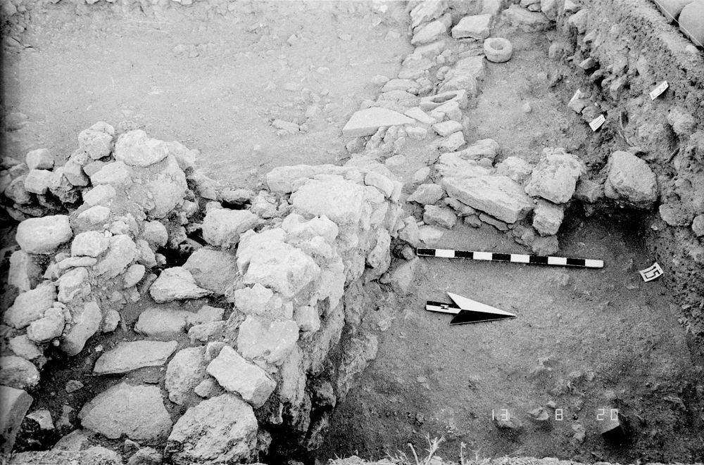
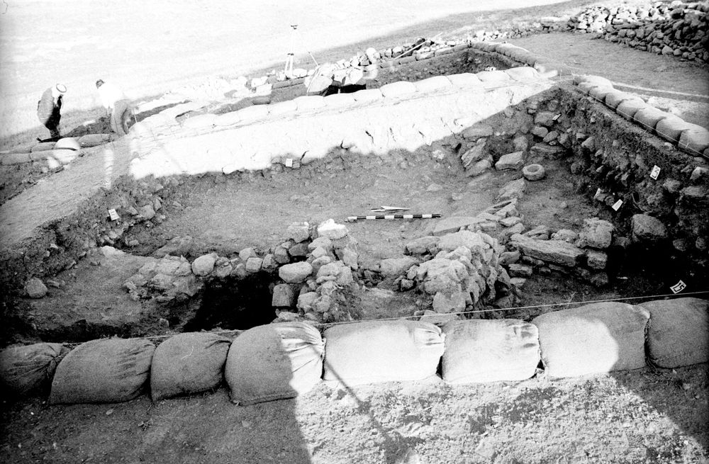
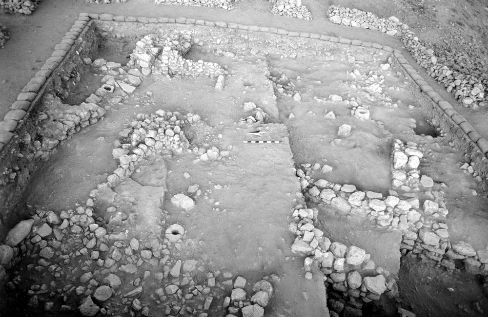
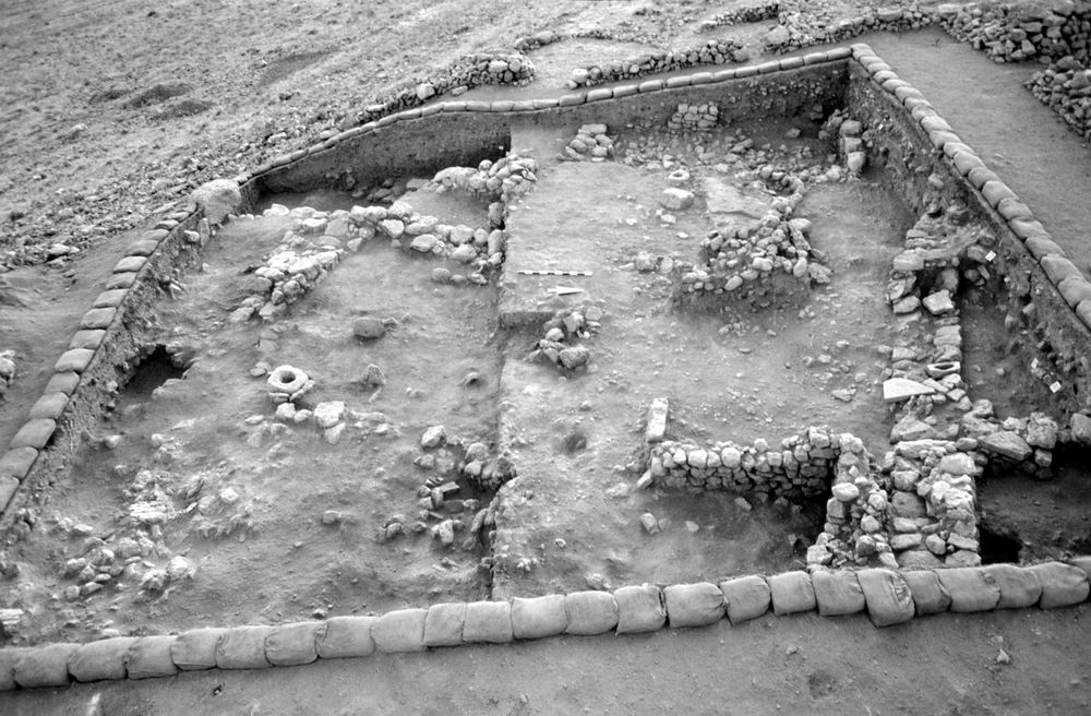
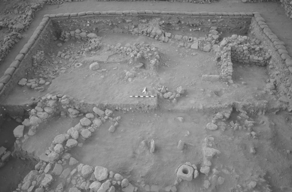
| Date | Photo Number | Subject | Photo |
|---|---|---|---|
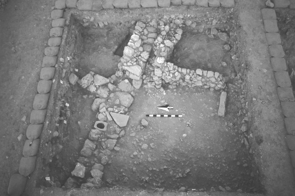
| 30 Jul, 1984 | 84D87515 | Final--aerial |
|
| 20 Jul, 1984 | 84D87346 | Walls |
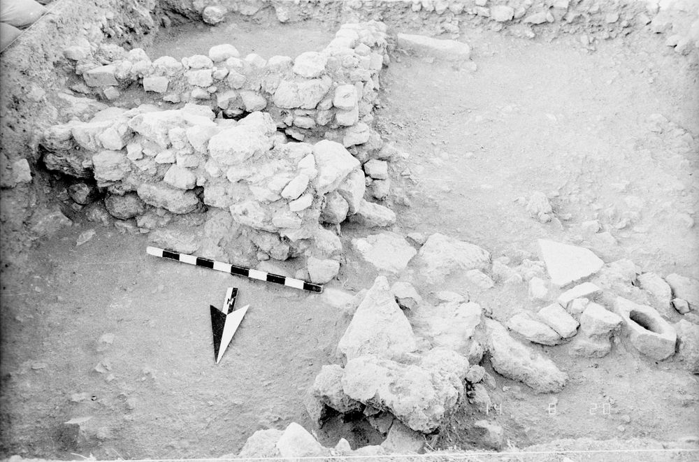
|
| 20 Jul, 1984 | 84D87347 | Walls |
|
| 20 Jul, 1984 | 84D87348 | Walls |
|
| 20 Jul, 1984 | 84D87349 | Walls |
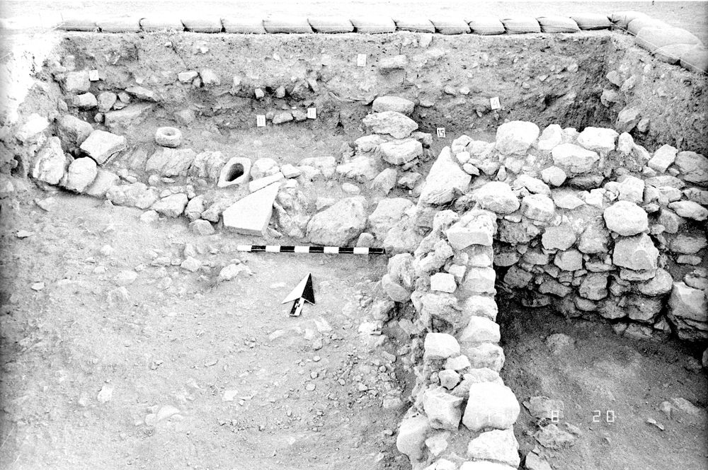
|
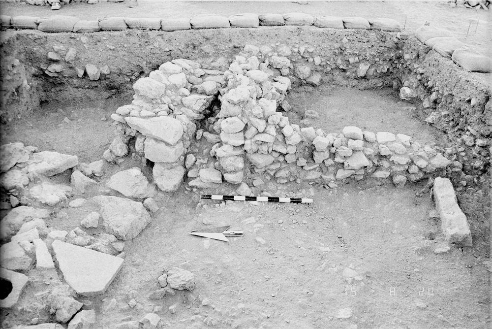
| 24 Jul, 1984 | 84D87394 | Progress |
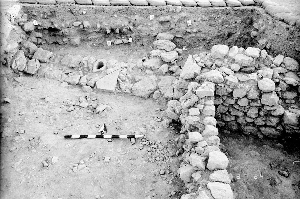
|
| 20 Jul, 1984 | 84D87345 | Progress |
|
| 18 Jul, 1984 | 84D87305 | Progress |
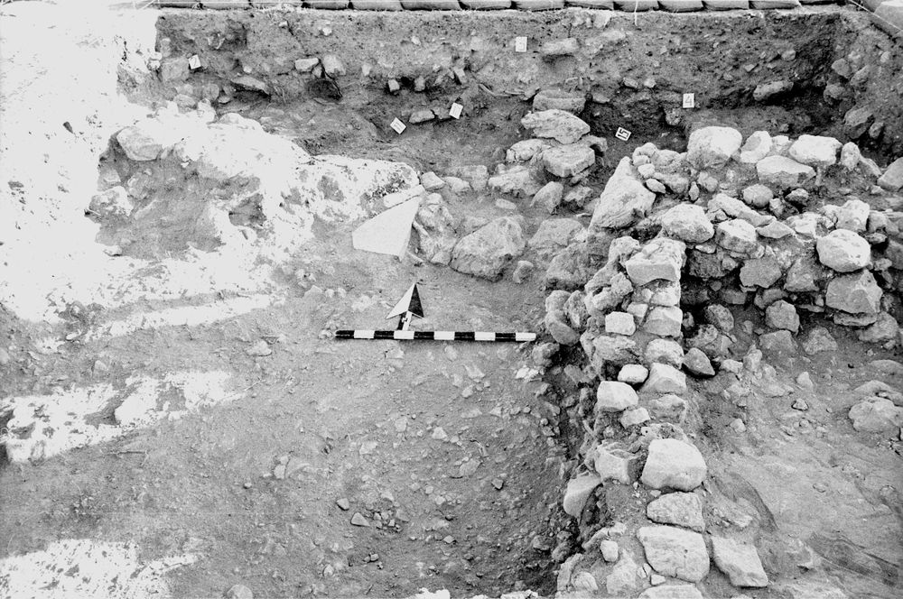
|
| 19 Jul, 1984 | 84D87327 | Progress |
|
| 05 Aug, 1984 | 84D86686 |
|
|
| 05 Aug, 1984 | 84D77687 |
|
|
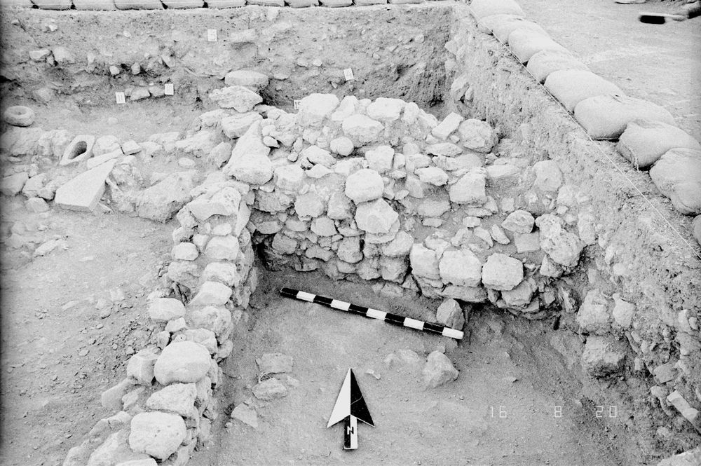
| 05 Aug, 1984 | 84D77688 | Final Field |
|