Locus B.7K92.026
General Information
Locus Type:
Earth
Supervisor:
W. Bowes
Designation:
Fill layer in large EIR1 refuse pit E of House B
Reason:
A layer of rocks (mostly cobbles) began to appear
Top Separation:
Arbitrary
Bottom Separation:
Very Clear
Start Date:
25 Jul, 1996
End Date:
26 Jul, 1996
Interpretation
Function:
Appears to consist of the same material as L 14 & 19; part of the refuse in large EIR1 refuse pit E of House B
Stratigraphy remarks:
Same material as L 14 & 19
Balk:
Phase:
Stratum :
Earth Description
Color
Munsell Number:
10YR 6/3
Texture
Texture:
Sand clay loam-Silty clay loam
Particle Shape A %:
0
Particle Shape AS %:
10
Particle Shape SR %:
30
Particle Shape R %:
60
Consistence
Hardness:
S. Loose
Compactness Description 1:
Crumbly
Compactness Degree 1:
moderately
Compactness Description 2:
Compactness Degree 2:
Wetness Description:
moist
Wetness Degree:
moderately
Structure:
Random
Measurements
Length:
4.5
Width:
3.6
Upper Depth:
0
Lower Depth:
0.83
Downslope Direction:
90
Degree of Slope:
10
Surface Material
Surface Material:
Laminated Surface:
0
Stone Inclusions
Pebbles (2mm-6cm)/bskt:
300
Cobbles (6 - 25cm)/bskt:
2.5
Boulders (25 cm+)/bskt:
0
Stone Distribution:
Layered
Earth Inclusions
Nari Frequency (per m2):
0
Nari Size (in m):
0
Brick Frequency (per m2):
0
Brick Size (in m):
0
Pebble Frequency (per m2):
0
Pebble Size (in m):
0
Ash Frequency (per m2):
1
Ash Size (in m):
1.38
Earth Distribution:
Layered
Artifact Inclusions
Pottery Frequency:
Flint Frequency:
Glass Totals:
0
Tesserae Totals:
0
Tabun Fragments:
0
Brick Fragments:
0
Roof Tiles:
0
Worked Stones:
0
Burned Stones:
Unfired Clay:
Arch. Fragments:
Artifact Distribution:
Organic Inclusions
Bone Frequency:
0
Olive Pits per basket:
0
Burned Wood per basket:
0
Burnt Wood Avg Size in cm:
UD per basket:
0
UD SAvg Size in cm:
0
Distribution:
Random
Remarks
Remarks:
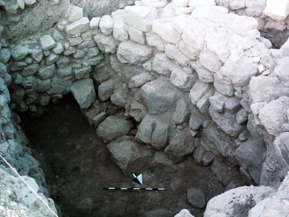
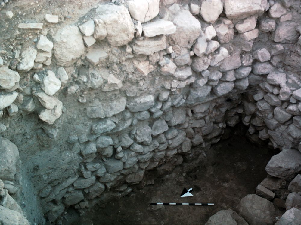
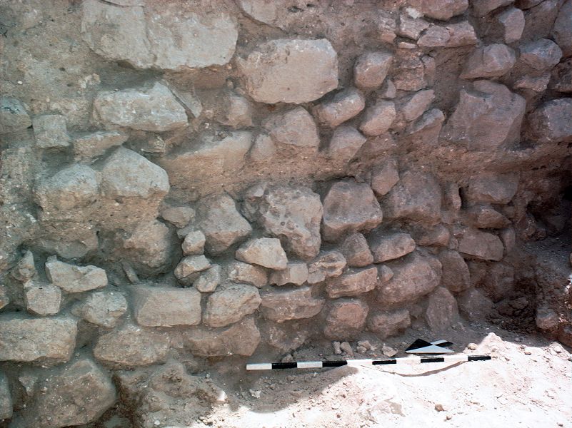
From about 910.8 to 910.4, the soil contained many cobbles; this did not appear to be wall tumble, but perhaps an attempt to level off the dump & cover the soil below; a black ash layer 4 cm thick appeared across the S meter; sloped down about 10 degrees to E; much bioturbation
Levels
| Location | Top Level | Bottom Level |
|---|---|---|
| 10 | 910.8 | 0 |
| 34 | 910.8 | 0 |
Stratigraphy
| Under | Earth layer | B7K92:014 |
| Under | Earth layer | B7K92:019 |
| Seals against | Wall | B7K92:024 |
| Equals | Earth layer | B7K92:014 |
| Equals | Earth layer | B7K92:019 |
Pails
| Number | Date | Baskets | Total | Diagnostic | Published | ||||||||||||||||||||||||||||||||||||
|---|---|---|---|---|---|---|---|---|---|---|---|---|---|---|---|---|---|---|---|---|---|---|---|---|---|---|---|---|---|---|---|---|---|---|---|---|---|---|---|---|---|
| 99 | 25 Jul, 1996 | 60 | 56 | 6 | 1 | ||||||||||||||||||||||||||||||||||||
Pottery Readings
|
|||||||||||||||||||||||||||||||||||||||||
| 100 | 26 Jul, 1996 | 63 | 84 | 14 | 0 | ||||||||||||||||||||||||||||||||||||
Pottery Readings
|
|||||||||||||||||||||||||||||||||||||||||
Photos
| Date | Photo Number | Subject | Photo |
|---|---|---|---|
| 23 Jul, 1996 | 96072325 | View from E |

|
| 26 Jul, 1996 | 96B92286 | Progress |
|
| 26 Jul, 1996 | 96B92285 | Progress |
|
| 24 Jul, 1996 | 96B92284 | Progress |
|
| 25 Jul, 1996 | 96072520 | Progress |
|