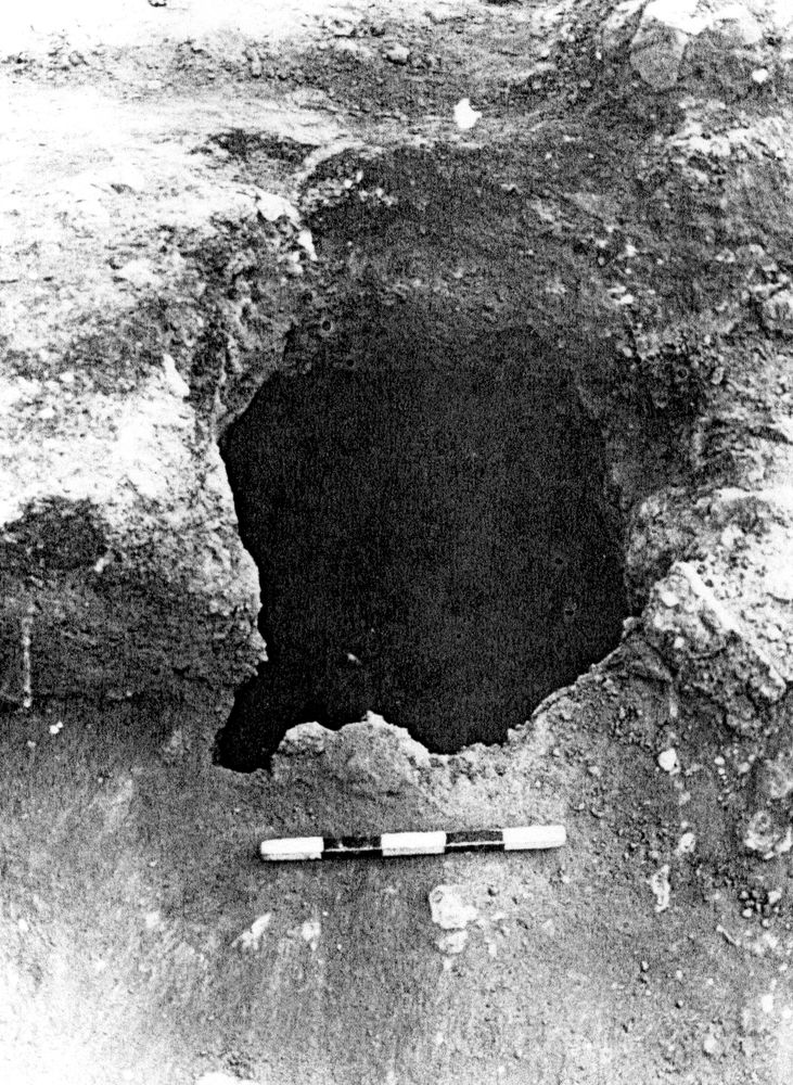
Locus B.7K80.051
General Information
Locus Type:
Installation
Supervisor:
T. Sanders
Designation:
Pit
Reason:
Line between loose & compact earth
Top Separation:
Clear
Bottom Separation:
Clear
Start Date:
18 Jul, 1989
End Date:
18 Jul, 1989
Interpretation
Function:
Pit for storage
Stratigraphy remarks:
51 was cut from L 36, a LIR2 surface which seals against the N side of Wall 25; it was cut into L 37, the bricky destruction of EIR1
Balk:
Phase:
Stratum :
Installation Description
Type
Certain:
Pit
Probable:
Possible 1:
Possible 2:
Material
Limestone Qualifier 1:
Limestone Qualifier 2:
Limestone Percent:
Bedrock Qualifier 1:
Bedrock Qualifier 2:
Bedrock Percent:
0
Ceramic Qualifier 1:
Ceramic Qualifier 2:
Ceramic Percent:
0
Mud Qualifier 1:
Mud Qualifier 2:
Mud Percent:
Mudbrick Qualifier 1:
Mudbrick Qualifier 2:
Mudbrick Percent:
Nari Qualifier 1:
Nari Qualifier 2:
Nari Percent:
0
Plaster Qualifier 1:
Plaster Qualifier 2:
Plaster Percent:
0
Earth Qualifier 1:
Earth Qualifier 2:
Earth Percent:
0
Stone Qualifier 1:
Stone Qualifier 2:
Stone Percent:
0
Plan
Type:
Oval
Quality 1:
Nearly
Quality 2:
Remarks:
Lining
Lining:
None
Measurements
Greatest Length in meters:
1.7
Greatest width in meters:
1.43
Smallest width in meters:
0.8
Greatest Height in meters:
1.09
Lowest Height in meters:
0.8
Orientation (degrees):
0
Remarks
Remarks:
Bell-shaped pit, circular opening with oval bottom
Levels
| Location | Top Level | Bottom Level |
|---|
Stratigraphy
| Cuts | Earth layer | B7K80:036 |
| Cuts | Earth layer | B7K80:037 |
Pails
| Number | Date | Baskets | Total | Diagnostic | Published |
|---|
Photos
| Date | Photo Number | Subject | Photo |
|---|---|---|---|
| 18 Jul, 1989 | 89B80237 | Pit 51 |
|